


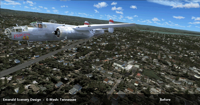
FSX/P3D/P3Dv2. It seems that Emerald Scenery Design is now venturing into the mesh business, having just released land mesh for the entire state of Tennessee. They are calling this new division of their organisation Emerald Mesh Development, E-Mesh for short.
According to their website, they base all of their mesh products on the latest 10 meter resolution data available. Some of their upcoming mesh coverage areas will also feature select areas in stunning 3 meter resolution land mesh. Of the newly released Tennessee mesh, 3 meter coverage areas include:
- Nashville
- Memphis Metro (area)
- Anderson, Campbell, Morgan, and Scott Counties
- Chattanooga
- Great Smoky Mountains
- Shelby County Rural Areas
The mesh is derived from 1/3 and 1/9 arc-second USGS elevation data. All files are optimized for best performance, based on a medium-end system.

Thanks to Jordan for the tip!
_______________________________________________
Check us out daily and like us on Facebook!
Go fly! We'll take care of the rest! Nobody has your back like AirDailyX.
daily news | reviews | first looks | billboard | interviews | comics | live broadcasts
5 comments:
I'm always astonished at how many developers fail at marketing their products professionally. I assume you guys put this animated graphic together, since neither of the above links show any such thing.
If you go to the fspilotshop "image" tab and the images are there
Yes, only two separate images and that's precisely my point! How difficult can it be to put together some animated gifs to help sell the product?
The product page speaks of 9 areas with 3 meter mesh coverage and all there is to see are 2 lousy screenshots. Marketing fail if I ever saw one.
Is it me, or does the second image look kinda...worse?
It looks like there's a hole in the ground with scenery textures melting down the side.
That picture is taken right off the airport at Chattanooga. There is actually some sort of mineral mine there. Look it up on google maps.
Post a Comment
Comments are now deactivated. Please visit our new website: AirDailyX.net
Note: Only a member of this blog may post a comment.